Free download
Can I Collect Here? The 5-Minute Land Status Checklist
A free 6-page PDF for rockhounds anywhere in the West. Five quick checks, all with free official tools, before the bucket comes out.
The five checks
- Pin the spot. Where you park and where you dig can be different land. Write down township, range and section.
- Who manages it? BLM, Forest Service, state trust land, park, refuge, tribal or private, using BLM's Surface Management Agency layer, USGS PAD-US and state trust-land maps.
- What's on top? Monuments, wilderness, ACECs, developed recreation sites, closures and fire orders that change the answer.
- Any mining claims? A step-by-step lookup in BLM's free MLRS, and how to read what it shows (including why "only closed claims" isn't an all-clear).
- What and how much? Rocks, petrified wood, fossils and artifacts: the federal baselines on BLM land, and why you start from "no" everywhere else.
What's inside
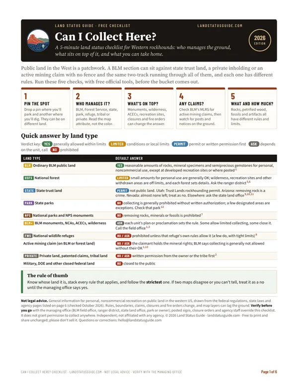
- A quick answer by land type: BLM, national forest, state trust land, state and national parks, BLM monuments and wilderness, refuges, mining claims and private land
- The free official map tools, what each one is for, and the map traps that catch people at section lines
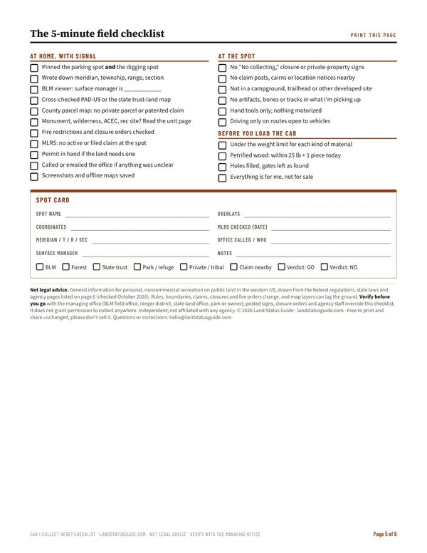
- A one-page printable field checklist and a fill-in spot card for your notes
- Sources for every rule: the federal regulations and agency pages, checked October 2026
It's general on purpose: the same five checks work in Utah, Nevada, Arizona, Oregon and the rest of the West. For one state in depth, see the state field guides ($14.99 each) for Utah, Nevada, Arizona and Oregon. Collecting in Utah? The one-page Utah cheat sheet is free too, no email needed.
Informational only — not legal advice. The checklist doesn't grant permission to collect anywhere. Confirm with the managing agency for the exact parcel before you collect. Last verified October 2026.