Flowchart · PDF
"Can I Collect Here?" Utah Flowchart
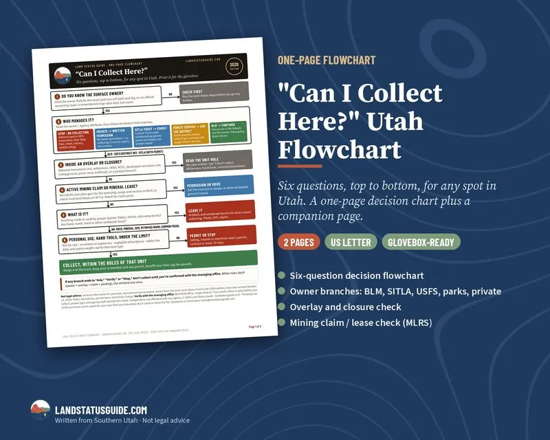
Six questions, top to bottom, for any spot in Utah. This printable flowchart walks you from "I found something" to a clear answer: collect, ask first, or stop.
Price: $4.99 · 2-page PDF, US Letter · instant download
The six questions
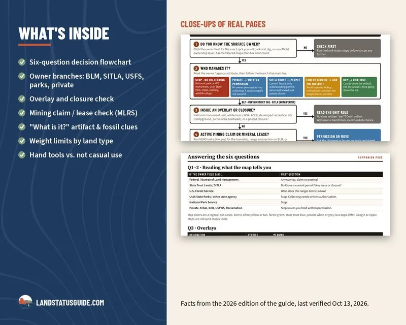
- Do you know the surface owner? (clicked on an official layer, not a remembered map color)
- Who manages it? Separate branches for national parks/state parks/tribal/military, private, SITLA trust land, Forest Service and BLM
- Is it inside an overlay or closure? Monument, wilderness/WSA, ACEC, developed recreation site, posted closure
- Is there an active mining claim or mineral lease?
- What is it? Artifacts and vertebrate fossils are never casual collecting
- Personal use, hand tools, under the limit?
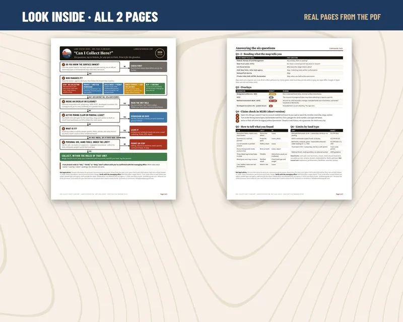
Page 2: the companion page
- How to read the owner field on a land-ownership map
- Overlay verdicts at a glance
- A short MLRS claim-check walkthrough
- "How to tell what you found" clues (flakes, points, sherds, bone, trilobites, petrified wood)
- Weight limits by land type, with sources
Print page 1 for the glovebox or a clipboard. Color-coded so it reads at a glance in bright sun. All facts are drawn from the 2026 Utah Land-Status Field Guide. If any branch ends in "Ask" or "Stop," the sheet tells you to confirm with the managing office before you collect.
What it isn't
No site directions or GPS pins, and it doesn’t replace a call to the managing office when a branch says "Ask."
Not legal advice. Facts come from the 2026 edition of the Utah Land-Status Field Guide, last verified October 13, 2026. Rules, boundaries and permit terms change; verify with the managing office (BLM field office, ranger district, Trust Lands office or park) before you collect. Independent; not affiliated with any agency.
Free reading first: Is rockhounding legal in Utah? and how to check a mining claim in MLRS. Every land type in detail: Utah Rockhounding Rules by Land Type. The whole state: the Utah Field Guide.