Site guide · PDF
Vernon Hills Wonderstone Rockhounding Site Guide (Utah)
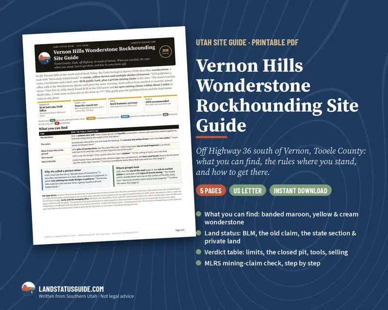
A 5-page printable PDF for the wonderstone site in the Vernon Hills, south of Vernon in Tooele County. The Utah Geological Survey describes wonderstone as a banded volcanic rock with folded swirls of cream, yellow-brown and maroon, and publishes a route and coordinates, with a warning: the land is BLM public land plus a private mining claim, so don't collect on marked claims or freshly mined rock piles. Our October 22, 2026 check found BLM land at the UGS point, no open mining claims within about 3 miles in BLM's data, and a state trust section on the drive in. This guide puts what the public sources say about the site in one place, plus the land-status rules for where you're standing.
Price: $5.99 · 5-page PDF, US Letter · instant download
Buy the Vernon Hills Wonderstone Site Guide - $5.99
What's inside
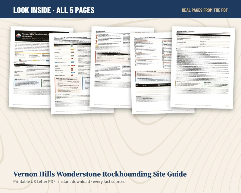
- Page 1: what you can find: what wonderstone is, where its maroon and yellow-brown colors come from, what it looks like on the ground, and where UGS says to look
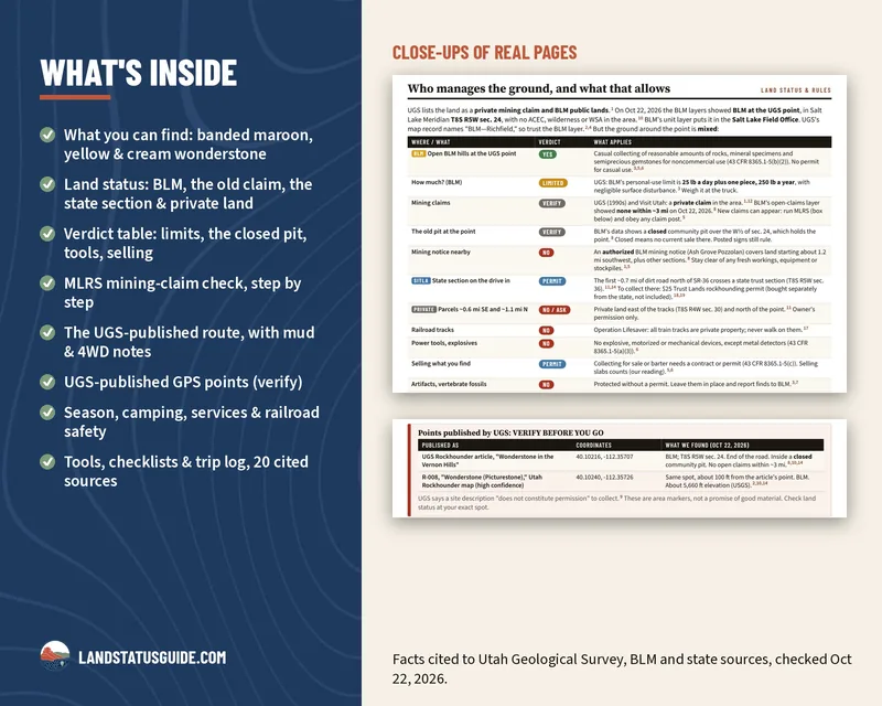
- Page 2: land status and rules with color-coded verdicts: BLM casual collecting and the personal-use limit (25 lb plus one piece a day, 250 lb a year), mining claims, the closed community pit at the point, a nearby mining notice, the state section and when you'd need a Trust Lands permit there ($25, bought separately from the state, not included), private land, the railroad, tools, selling and artifacts, plus a step-by-step MLRS mining-claim check and a private and state-land check
- Page 3: getting there on the UGS-published route off Highway 36, where the sources disagree on mileage, 4WD and clay-mud notes, the two UGS-published coordinates (marked "verify before you go") with what's at each, season, camping, services and cell signal
- Page 4: tools to bring and leave home, backroad and railroad safety, before-you-collect and drive-out checklists, and a trip log
- Page 5: who to contact (BLM Salt Lake Field Office, Trust Lands, UGS, MLRS, fire info) and 20 numbered sources, each with its link
What it isn't
No secret GPS pins or "honey hole" directions, and no promise of finds. The only coordinates are the ones the Utah Geological Survey publishes. Where a public source didn’t confirm something (a season, fuel, cell coverage, today's claims), the guide says so and tells you who to ask.
Good for
Wasatch Front day-trippers, families, first-time rockhounds, and anyone who wants banded rock to slab at home.
Buy the Vernon Hills Wonderstone Site Guide - $5.99
Not legal advice. Facts come from public Utah Geological Survey, BLM and state sources, checked October 22, 2026, and the 2026 Utah Land-Status Field Guide. Rules, boundaries, mining claims and permit terms change; verify with the managing office (BLM Salt Lake Field Office, or Trust Lands for a state section) before you collect. Independent; not affiliated with any agency or business.
Free background first: how to check a mining claim in MLRS, SITLA vs BLM and BLM collecting limits. The whole state: the Utah Field Guide. More site guides: Dugway Geode Beds, Topaz Mountain and Caineville. Before you go: How to Check for Mining Claims Before You Collect (Utah).